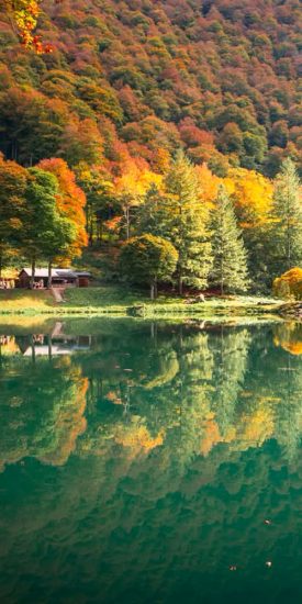
 Autumn getaways in the Pyrenees
 Living traditions
 Hydrotherapy
 The must-see sites
 Gourmet and local know-how
 The Couserans through the seasons
 The Blog… inspirations throughout the seasons
 Holiday ideas
 Our CSR approach
 Hiking in the Couserans
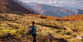 Current hikes
 Thrills & Spills
 Sports activities
 Equestrian activities
 Guzet station
 Trail running in Couserans
 Cycling and mountain biking
 Where to stay?
 Where to eat?
 GOING OUT IN TROUVILLE-SUR-MER
 What to do there?
 Tell us about your visit to Ariège
 Tickets
 Local markets
 The events calendar
 Major events
 The local Anims
 Sport events
 Art & Culture
 Add your event

Are you going hiking? The best thing to do is to be well informed! Come and meet us at our various information points to get personalized advice, adapt your hike the next day according to the weather forecast, take stock of the trail conditions, and assess your level of practice.
Going hiking? Here are some tips to adopt!
“In the mountains, whether it’s for a simple walk or a sporty hike, preparation must be systematic.
Anthony
If possible, come and meet us at our various information points to get personalized advice, adapt your hike the next day according to the weather, take stock of the condition of the trail, and assess your level of practice.

Equipment
- Leave with some hiking boots on the feet, high if possible to support your ankles on descents;
- Le backpack is the other essential: it must contain at least some water in sufficient quantity (and/or micropur tablets if you are going for longer), food (even on a short walk), a small first aid kit, a jacket raincoat (even if it's nice at first), a cap and sunscreen, a phone and a fact sheet or a hiking map (see list below), and for maximum security a blanket, a front and whistle.
- If you walk for a long time, or are physically weakened, The sticks can be very useful: this accessory is recommended for all people who go hiking, even on snowshoesBelow you will find all the tips to follow in winter.

The Marking
The marking of major routes (GR10 and cross-border GR trails) takes precedence over all other markings. Therefore, a hike may use three categories of markings, in whole or in part :
- White and red : Long-distance hiking trail (GR) 10 or cross-border;
- Yellow and red : Long Country Hiking Trail (GRP of the Tour du Val de Garbet or the Tour du Biros).
- Saffron yellow : Short Hiking Trail (PR).

Trail maintenance
The Couserans region boasts over 3200 km of trails , maintained by the Couserans Pyrénées Community of Municipalities. Despite their best efforts, issues may need to be reported: fallen trees, delayed brush clearing, collapsed walls, etc. To report these effectively, use the Suricate platform : it's quick and all stakeholders are informed of the problems immediately.

In the Land of Shepherds
Hikers, you share the mountains with other users! Like tourism, pastoralism is an essential activity for the local economy. In Ariège, high-altitude pastures represent nearly 25% of the department's surface area.
The breeders graze their animals for 3 to 4 months in the summer pastures, which limits the progression of the forest and maintains vast open landscapes, to the delight of hikers! It also contributes to soil stabilization, the fight against fire risks, and the preservation of biodiversity by maintaining open environments. When you come across a herd and pastoral equipment
(huts, fences, dogs), follow a few common sense rules: keep your distance, close the fences after you have been there... Download here an explanatory brochure on this sharing of space with shepherds, by the pastoral federation of Ariège.

Shepherd dogs, patous
Dogs are allowed everywhere in Couserans. However, herds and wild animals are present in the mountains: keep your dog on a leash.
Patous, guardians of the flocks: knowing and preventing the risks
If they spot a potential danger, they first try to identify it by approaching. If they determine it's not a threat, they move on. Otherwise, they try to drive the intruder away by positioning themselves between it and the flock . In this case, they usually begin by barking to alert the herder, deter, and intimidate.
- Stay on the trails. If you're in an area where there's regular hikers, the dogs are probably used to it.
- Look for signs indicating the presence of these dogs. Of course, you won't encounter patous at every sign, and it's possible to encounter them where there are no signs.
- If you see a herd in the distance, look for a herd dog.
- If there is one, keep your distance. Better to take a detour than get a fright.
What to do in case of an encounter?
If you see a mountain dog, most of the time it has already spotted or smelled you. Here are some tips:
- Don't panic. Dogs sense your fear and are extremely wary of it.
- Don't surprise them. Dogs can have poor defensive reflexes.
- Stay calm and move slowly and non-aggressively. Don't run, shout, wave your arms, throw objects at him, threaten him with sticks, etc. Most of the time, he's just coming to identify you.
- Speak calmly to him to put him at ease when he approaches you. This also gives you composure if you are afraid.
- If the dog is friendly, do not pet it, take pictures of it, or feed it.
- If the dog tries to intimidate you: it means it sees you as a threat. Move slowly and calmly away from the herd.
- Don't force your way in, you risk appearing as a threat.
- Go around the herd as best you can.
- If the dog follows you, ignore it. These dogs may follow you until they consider you far enough away from the herd.
- If you are with your children, keep them away.
- If you are with your pet dog, keep it on a leash and let the guard dog approach it so they can smell and get to know each other.

Presence of the brown bear
In case of meeting, very unlikely but possible, what to do? Here is the recommendations from the Ours technical team (prefecture of the Occitanie region):
« If you encounter a bear at close range (less than 50 m), help him identify you :
➟ Make your presence known calmly by showing yourself, moving around, and speaking
➟ Gradually move away , avoiding the route he might take in his escape
➟ Don't run
The bear may stand on its hind legs: this is not a sign of aggression. It is curious; it seeks to recognize smells and better identify you.
If you have any comments, we are interested in hearing your feedback. Please contact :
Bear Technical Team
Tel: 05 62 00 81 08
Mail: »

Recommendations
for the winter season
The snow conditions and the weather situation are to be known, before going on a hike, in snowshoes, ski touring, etc. We cannot necessarily go snowshoeing on all the trails that we found pretty in the summer: avalanche paths are known and prevent certain routes.
Winter more than ever, be humble and careful : come seek advice from us in Tourist Offices to find out the best hiking options on the day, check the weather, road information and why not leave with one mountain guide for your “first time” !

Weather
The weather changes very quickly in the mountains!
Consult the local Météo France server at 08 99 71 02 99, download a reliable weather app, or find the local mountain weather displayed in the various tourist office receptions.

Topographic maps
- the IGN Top 25 card n° 2048 OT (Aulus les bains /Mont Valier) covers most of the mountain area.
- the IGN Top 25 n°2148 OT card (Vicdessos/Pique d'Estats, Pic de Montcalm) covers the area east of Aulus les Bains.
- the IGN Top 25 map n°2047 ET (Massat/ Pic des Trois Seigneurs, PNR of the Ariège Pyrenees) the entire part of Massatois up to Séronais.
- the IGN Top 25 n°2047 OT card (Saint-Girons/ Couserans) and IGN Top 25 map no. 2046 O (Sainte Croix Volvestre) cover the area of the Couserannais foothills.
We sell locally designed guidebooks , topographic maps and fact sheets specific to each walk or hike on site in our reception offices .

Directions
Consult the Inforoutes09 website to be informed in a timely manner about the state of the roads in Ariège.